


Software-defined lidar provider AEye, Inc. has announced that it will showcase a live ITS (intelligent transportation systems) deployment in partnership with the Michigan Department of Transportation (MDOT) at the ITS America conference at Huntington Place in Detroit on June 10-12. Powered by the company’s OPTIS platform, its solution delivers long-range, real-time 3D perception that enables transportation systems like MDOT to continuously monitor, understand, and act on roadway activity.
“Transportation infrastructure is evolving from passive monitoring to intelligent systems that can perceive, understand, and respond to conditions in real time,” said Matt Fisch, Chairman and CEO of AEye. “At ITS America, we’re excited to showcase how software-defined lidar and physical AI can help transportation agencies improve safety, optimize traffic operations, and build smarter, more responsive roadways. Visitors at ITS America will have the opportunity to see how AEye and its partners are helping transportation agencies move beyond traditional sensing toward intelligent infrastructure capable of delivering real-time insights and action across diverse roadway environments.”
The demonstration will highlight the OPTIS solution’s combination of software-defined lidar and real-time infrastructure integration, and its ability to improve roadway safety, traffic operations, and situational awareness across urban street intersections and highways. The deployment incorporates AEye’s software-defined Apollo lidar, Flasheye‘s lidar perception software, and Blue Band‘s Integrator-AI solution, an end-to-end system capable of transforming sensor data into actionable traffic intelligence.
AEye announced in September 2025 a strategic partnership to integrate Flasheye’s advanced perception engine into the OPTIS platform, delivering on its commitment to create a full-stack 3D visual awareness system that delivers real-time detection and analysis across critical use cases in infrastructure, transportation, and safety applications. The combination of AEye’s ultra-long-range, software-definable lidar with Flasheye’s perception technology is said to deliver a scalable, intelligent system capable of detecting objects up to 1 km (0.6 mi) away.
The partnership marked an important milestone for Flasheye, according to Gustav Nordlund, CEO of Flasheye: “By combining AEye’s software-defined Apollo sensor with our lightweight and modular edge perception software, we can address multiple markets and use cases while keeping a unified hardware and software platform.”
In August, AEye announced a partnership that integrates its Apollo lidar technology with Blue-Band’s advanced Integrator-AI platform as part of the OPTIS initiative. The combination leverages AEye’s long-range Apollo lidar with Blue-Band’s AI-powered orchestration platform, bringing together sensing, computing, advanced 3D perception, and AI to deliver real-time insights for transportation and smart infrastructure applications.
“Partnering with AEye brings the power of long-range lidar to our platform, enhancing our ability to provide intelligent, scalable solutions for traffic management and urban mobility,” said Kevin Yorke, CEO of Blue-Band.
The partnership extends OPTIS’ capability to interface directly with traffic control systems, providing real-time analytics to enable lifesaving and congestion-reducing actions at traffic intersections. It will initially focus on deploying integrated solutions for traffic monitoring, incident detection, and infrastructure intelligence, with a shared vision of accelerating the shift toward safer, smarter, and more adaptive cities.
According to AEye, MDOT’s adoption as an early government partner sets the operational benchmark for physical AI in public infrastructure and the procurement standards that will follow nationally.
The sensing opportunity in public infrastructure is larger and more durable than the AV market it was once bundled with. State DOTs represent a new class of buyers with real budgets and immediate deployment needs.
AEye’s software-configurable architecture means what works on Michigan highways can be adapted to ports, airports, and logistics corridors without starting over.
Initially focused on lidar solutions for autonomous mobility, AEye rolled out a strategic diversification plan in 2021 that expanded the company’s offerings of sensing technology for public infrastructure, intersection management, and highway incident detection. In the summer of 2025, the Pleasanton, CA-based company officially expanded into the physical AI space by launching OPTIS, enabling it to be implemented as a permanent roadside solution for traffic monitoring, security and smart city data.
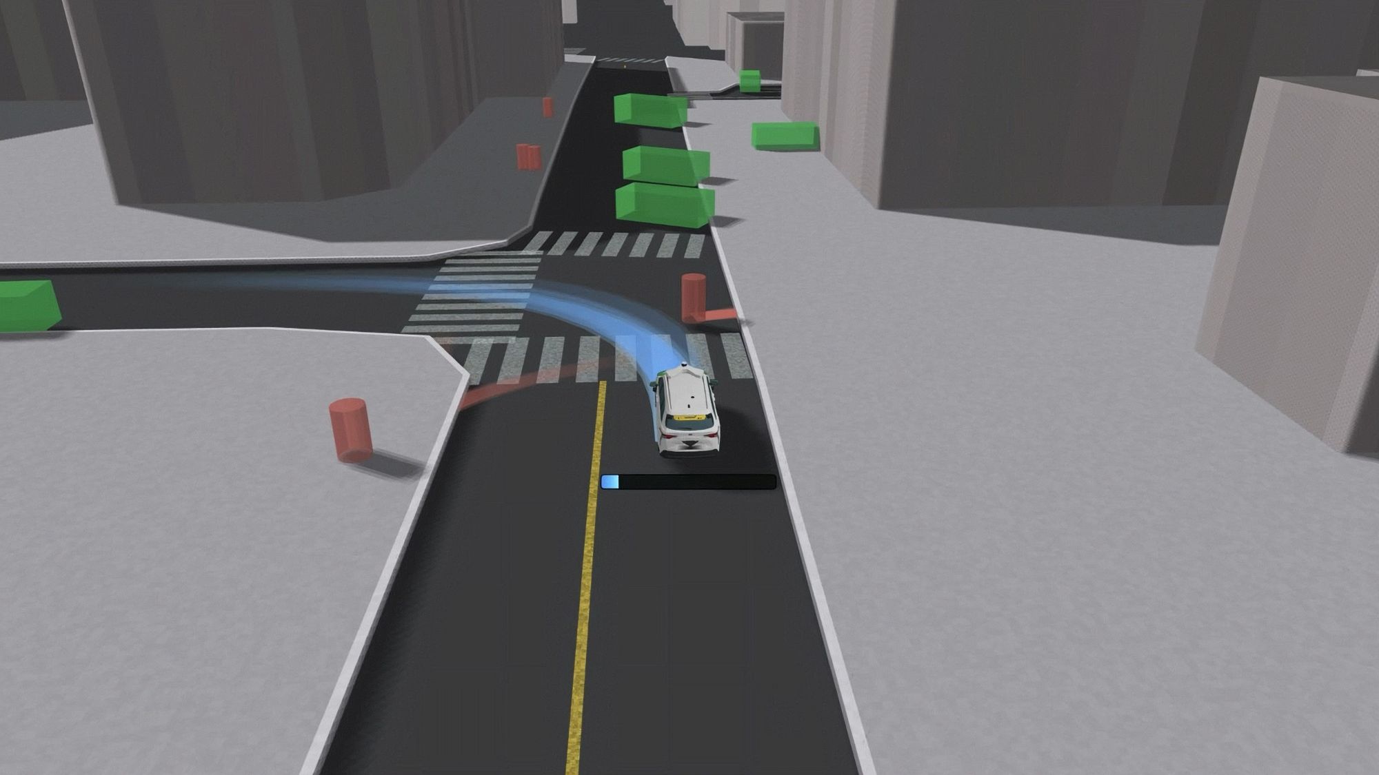
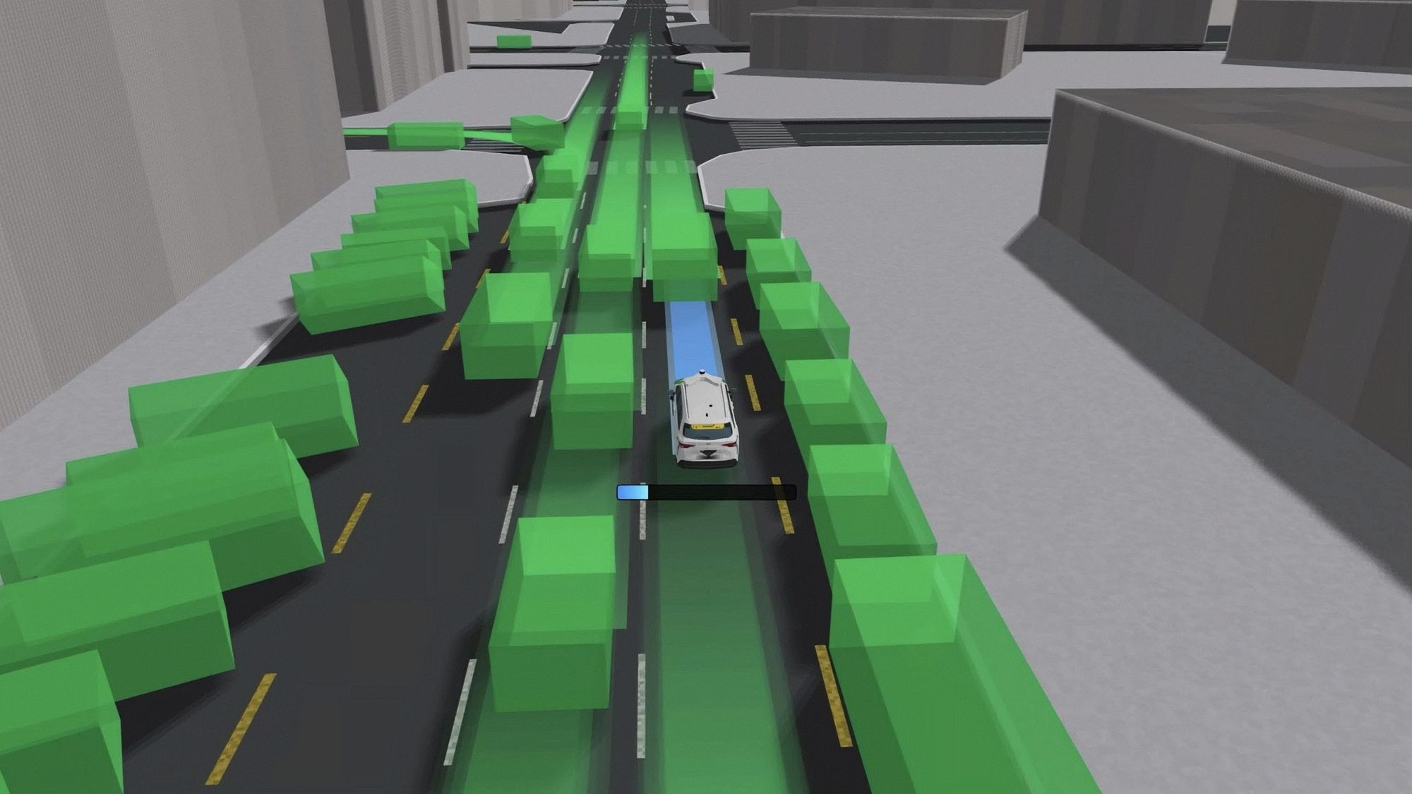
OPTIS is an autonomous lidar system that delivers high-resolution 3D perception of the physical world and enables real-time interpretation and responsive action. Designed to enhance legacy infrastructure systems, such as traffic cameras, the company says that OPTIS can help fuel the transformation to intelligent, connected systems as the world shifts towards smart infrastructure enabled by physical AI.
-

- AEye’s OPTIS 3D image point cloud perception for real-time interpretation and action.
-

- AEye will showcase its OPTIS lidar solution at ITS America in Detroit.


