


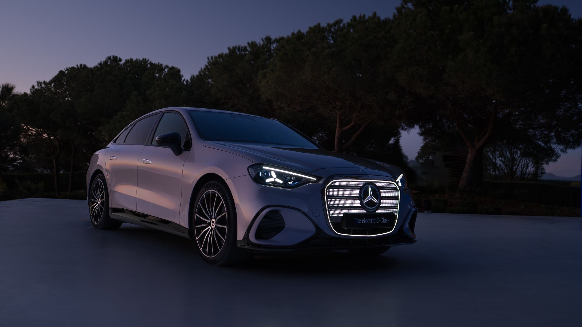
CES 2021 was a busy event for location data and services provider Here Technologies. The Netherlands-based company used the virtual event to introduce a new feature aimed at EV (electric vehicle) manufacturers and consumers, as well as a series of new 3D city models for navigation system designers. Here also announced a new partnership with Continental and display technology company Leia, Inc. to provide new 3D navigation on Leia’s Lightfield automotive displays.
One of the biggest concerns among consumers when considering an electric vehicle (EV) purchase is vehicle range. It’s no secret that EV charging stations aren’t as abundant as those for gasoline and diesel, particularly here in North America. Until the infrastructure catches up to the EV population, range anxiety will continue to be a hindrance to EV sales.
Here aims to help reduce range anxiety with its new EV Routing product, a new navigation feature in its maps, and ADAS products designed to optimize private and commercial EV traffic. It uses topography, road geometry, real-time traffic information, and patterns while planning trips to minimize charging stops and reducing battery-charging time based on a vehicle’s consumption model.
The EV Routing feature allows for adjustment based on driving styles, vehicle loads, or weather conditions. It also leverages Here Charge Points, a database that includes vehicle brand, real-time charging-station availability, subscription, and pricing information.
“EV Routing does more than show you the way to a charging station,” said Jussi Koski, Vice President of Product Management at Here Technologies. “It provides the most optimal route, including charging times, while taking into account static and dynamic data such as charging speed or real-time traffic conditions. Not only is EV Routing based on a wide range of parameters, but it can also be customized. With EV Routing, Here goes beyond removing range anxiety and makes EV driving a truly personalized experience.”
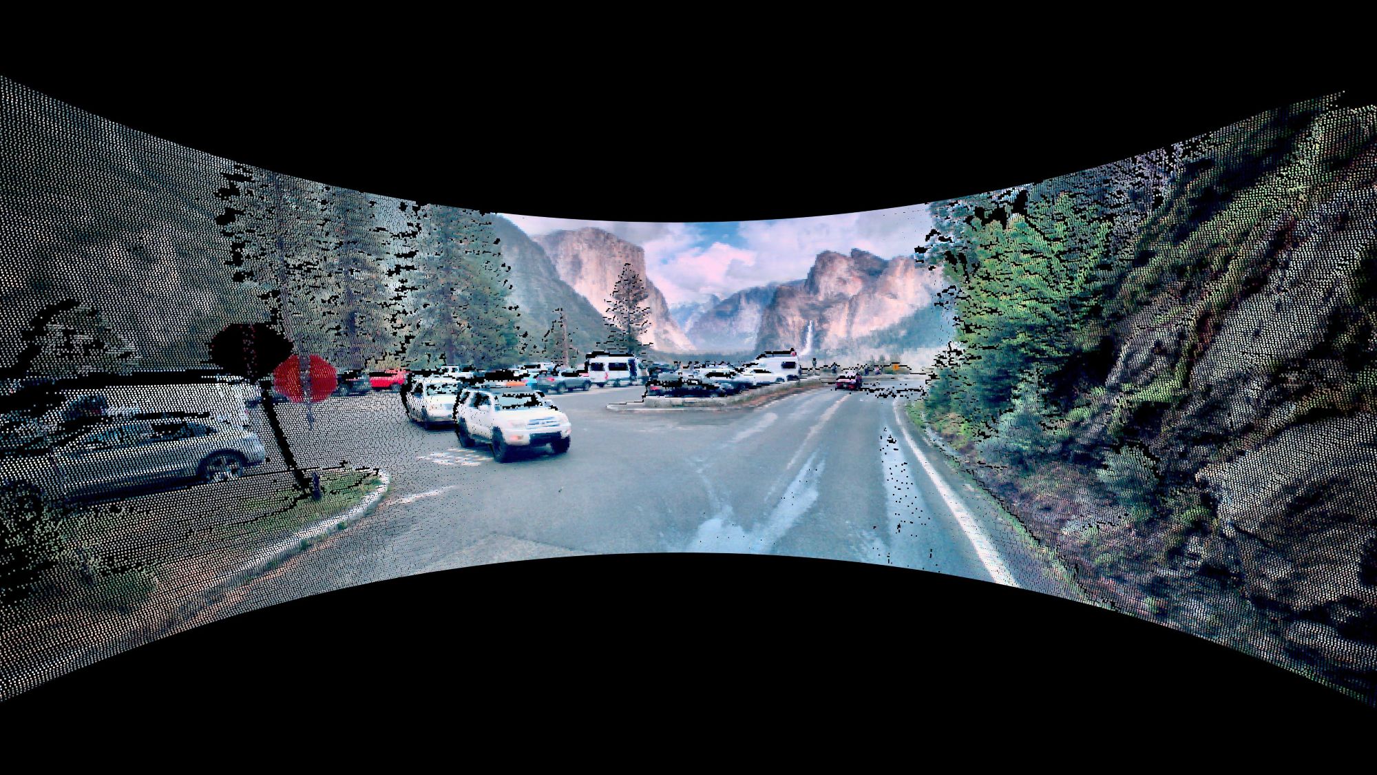
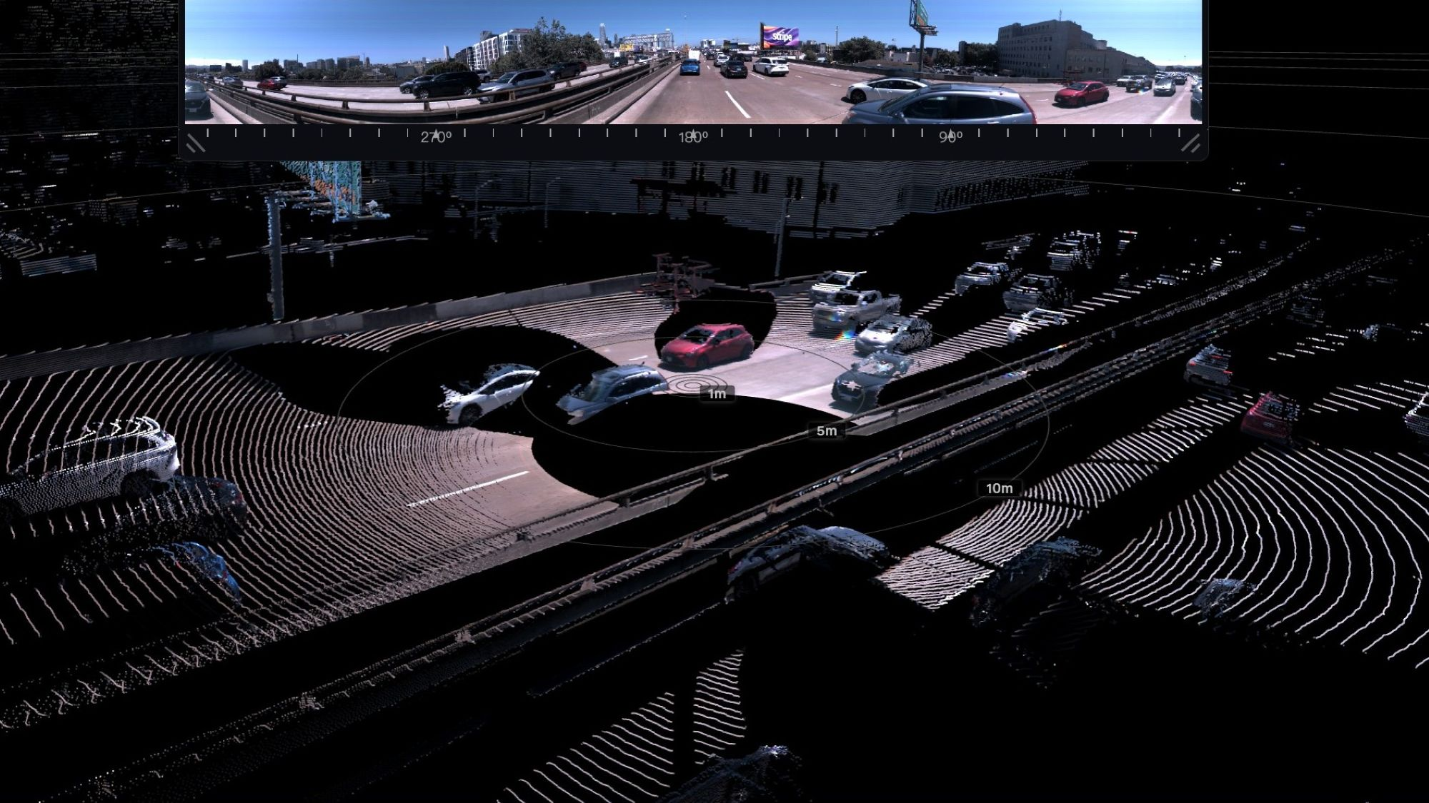
Another new mapping product announced by Here at CES 2021 is a collection of high-fidelity 3D models of 75 city centers around the world, called Here Premier 3D Cities. Designed to offer software developers the geospatial data necessary to build real-world city visualizations within navigation systems, the 3D models contain rich data layers and attributes that are aligned to physical geometry, structures, and terrain.
The company says Here Premier 3D Cities will offer many benefits to end-users and designers. It will enable last-mile delivery drivers to better navigate dense cities with maps that highlight precise building dimensions and entry points along their delivery routes. The product also gives the entertainment industry the building blocks for virtual site visits and seamless computer-generated imagery integration. Telecommunications companies can optimize their buildouts of 5G networks in 3D, and urban planners and emergency responders can build digital twins for better land use analysis and disaster readiness simulations.
Some Here 3D city models are currently in use in the Audi A8 luxury sedan.
“With the enterprise developer in mind, Here has captured, indexed, and mapped the world’s major road networks and urban centers in 3D,” said Jørgen Behrens, Senior Vice President and Chief Product Officer, Here Technologies. “We’re excited to see how these unique 3D city models open up a world of possibilities and value for businesses. They are the building blocks to create accurate, sub-meter augmented-reality applications that are transforming supply chains, transportation and mobility networks, and overall consumer experiences.”
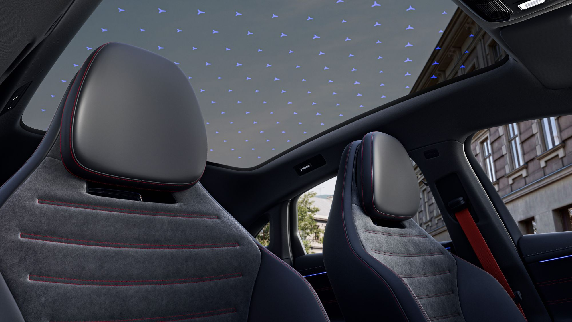
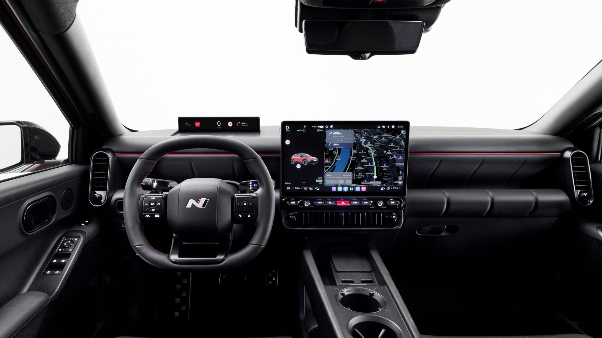
The introduction of Premier 3D Cities has also helped Here forge a new partnership with Leia and Continental. The combination of Continental’s Natural 3D Display and Leia’s Lightfield software with Here Premier 3D Cities presents a new 3D navigation display solution for OEMs to integrate into vehicle cockpits.
Here’s 3D depiction of buildings and topography will be displayed in Continental automotive display solutions using Leia’s Lightfield software, which allows for the visualization of 3D maps for extended periods of time without the need for adaptive eyewear or an eye-tracking sensor. The company says this partnership will position 3D maps as an essential building block for Leia’s Lightfield automotive software development kit (SDK). The goal is for Leia, Continental, and Here to create a spatial reproduction of the real world that will help drivers better orientate themselves and stay more alert while driving.
“Maps form the basis of any automotive SDK,” said David Fattal, Leia’s Co-founder and CEO. “We are really pleased to be combining our Lightfield software with Here 3D cities data and Continental’s display solution to be able to offer all OEMs a cutting-edge navigation experience.”
“3D display technology not only brings a new wow-factor into the cockpit but with the right content, it also creates a more intuitive interaction between driver and vehicle and thus enhances driving safety”, said Ulrich Lueders, Head of Strategy and Portfolio at Continental’s business unit for Human Machine Interface. “As we see this especially for 3D navigation, I am very happy that we can contribute to a better UX and safer driving environment by bringing together Here premium map content and Leia’s Lightfield software with our expertise in automotive human-machine interface solutions.”
“Lightfield technology generates astounding 3D experiences for drivers without the need to wear special eyewear,” said Adrián Novik, Senior Director for Product Management, Here Technologies. “That is why we have chosen this technology to bring our premium 3D cities data to life. We look forward to showcasing the results of our collaboration to our many automotive customers.”


